


Voting District 30160, Kern County, California
About
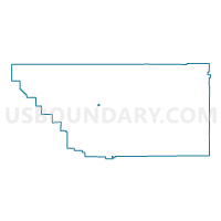
Outline

Summary
| Unique Area Identifier | 531180 |
| Name | Voting District 30160 |
| County | Kern County |
| State | California |
| Area (square miles) | 0.90 |
| Land Area (square miles) | 0.86 |
| Water Area (square miles) | 0.03 |
| % of Land Area | 96.12 |
| % of Water Area | 3.88 |
| Latitude of the Internal Point | 35.35946390 |
| Longtitude of the Internal Point | -119.06539500 |
Maps


Graphs
Select a template below for downloading or customizing gragh for Voting District 30160, Kern County, California


Neighbors
Neighoring Voting District (by Name) Neighboring Voting District on the Map
- Voting District 30095, Kern County, CA
- Voting District 30130, Kern County, CA
- Voting District 30145, Kern County, CA
- Voting District 30150, Kern County, CA
- Voting District 30165, Kern County, CA
- Voting District 30175, Kern County, CA
- Voting District 40780, Kern County, CA
- Voting District 40790, Kern County, CA
- Voting District 40880, Kern County, CA
Top 10 Neighboring County Subdivision (by Population) Neighboring County Subdivision on the Map
Top 10 Neighboring Place (by Population) Neighboring Place on the Map
Top 10 Neighboring Elementary School District (by Population) Neighboring Elementary School District on the Map
- Bakersfield City Elementary School District, CA (185,976)
- Panama-Buena Vista Union Elementary School District, CA (119,146)
- Fruitvale Elementary School District, CA (20,382)
Top 10 Neighboring Secondary School District (by Population) Neighboring Secondary School District on the Map
Top 10 Neighboring State Legislative District Lower Chamber (by Population) Neighboring State Legislative District Lower Chamber on the Map
Top 10 Neighboring State Legislative District Upper Chamber (by Population) Neighboring State Legislative District Upper Chamber on the Map
Top 10 Neighboring 111th Congressional District (by Population) Neighboring 111th Congressional District on the Map
Top 10 Neighboring Census Tract (by Population) Neighboring Census Tract on the Map
- Census Tract 18.01, Kern County, CA (5,579)
- Census Tract 18.02, Kern County, CA (5,408)
- Census Tract 28.12, Kern County, CA (5,215)
- Census Tract 28.07, Kern County, CA (3,894)
- Census Tract 5.07, Kern County, CA (3,598)
- Census Tract 28.04, Kern County, CA (2,672)